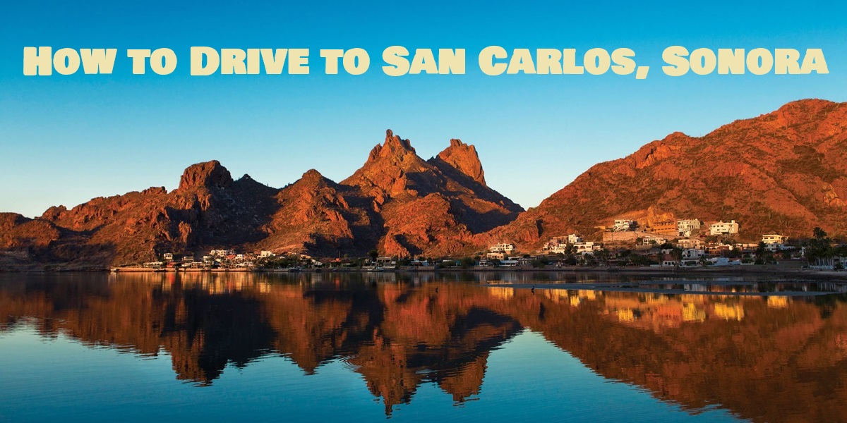
Thinking about driving to San Carlos, Sonora, Mexico? You’re not alone—thousands of travelers make the trip every year for its turquoise waters, relaxed pace, and scenic desert highways. The good news is that driving to Mexico is easy and safe when you know what to expect. As long-time San Carlos residents and travel writers, we’ve made this drive countless times and gathered all the essential tips—border crossings, tolls, insurance, and safety checks—to help you plan a smooth, stress-free road trip from Arizona (or beyond) straight to paradise.
Driving from Arizona (Phoenix or Tucson) to San Carlos, Sonora:
Take the I-10 east to Tucson, Arizona. From Tucson, head south on Interstate 19 to Nogales, Arizona. If you stay on I-19 until the border, you will have to go through down-town Nogales. There is a second border crossing option that is often quicker and easier (especially if you are in a larger vehicle or towing a boat or RV) — take the Mariposa border crossing (aka, the truck crossing) at Hwy 189, exit 4. This crossing is open from 6:00am until 10:00pm. The Nogales crossing is open 24 hours.
Once you cross into Nogales, Mexico, continue south on Highway 15. You will pass several towns on the way. The most notable are Magdalena, Santa Ana and Hermosillo. If you don’t see a sign saying San Carlos, don’t panic. After Hermosillo, you will see signs for Guaymas. The Guaymas airport is 10 minutes from San Carlos. You will see the San Carlos sign as you get closer to Guaymas. From Phoenix, it is approximately a 7 hour drive. From Tucson, it is approximately a 5 hour drive.
Check below for a detailed driving map from Arizona to San Carlos Mexico.
Driving across the Border into Mexico
When you arrive at the border, drive slowly to the spot with the stop signs. Continue to drive slowly and look left. You will either see a flashing red Alto (stop) sign, or a green Pase (go). If it says Pase, do just that. Go on your way and begin the last four hours of your trip. If it says Alto, pull over to where the Mexican border patrol officers direct you and answer any questions that they have. Usually, it is “What is your destination?”, or they may quickly look in the trunk of your car and then allow you to go on your way.
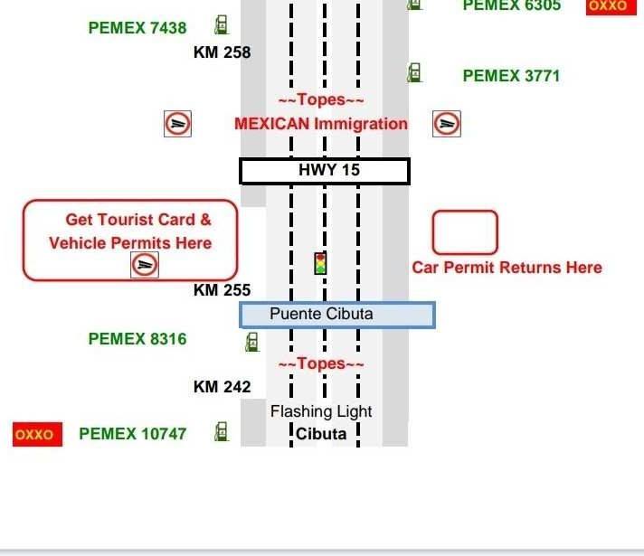
At Km 21, stop for your Tourist Visa: When driving into Mexico, you have to stop at Kilometer 21 to get a Tourist Visa. This checkpoint is very well marked. Go to the white building and show the immigration official your passport, then complete and sign the Visa form that the officials will give you. They will then stamp the Visa and fill in how many days it is valid for. Take the Visa to the adjacent bank and pay the fee.
Foreign vehicles may be driven in the northwest of Sonora without any temporary vehicle importation permit (this includes San Carlos and Guaymas). Otherwise, if you will be traveling outside of the “Only Sonora” Zone, you will need a permit for your vehicle. You can get one at km21 or apply for one online and it will be mailed to you.
You can check border crossing times and conditions here, here and here.
Kilometer 21 Directions:

The Hermosillo By-Pass
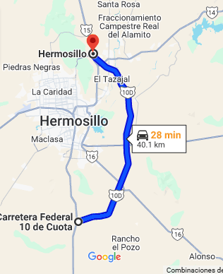
The Sonoran government has built a bypass toll road around Hermosillo (facebook page). It’s just over 40 kilometers and the claim is that it will save 40 minutes of travel time between the border and places south of Hermosillo. The goal is also to prevent heavy vehicles from traveling through the city.
The cost per car is 151 pesos (as of March 2026).
Watch for the signs for directions going north and south along Highway 15.
The turn going North is well signed. Before Hermosillo, there’s a ramp to the right.
Going South, go through the Hermosillo tollbooth and watch for the sign for Guaymas. Follow the Guaymas exit, on the left. This video shows the southbound on-ramp ramp:
Car Insurance for Mexico
Make sure that you have car insurance for Mexico if you are going to drive in Mexico, because U.S. and Canadian insurance policies are not recognized here. For a free online quote, visit Sanborn’s Insurance. If you have any questions about purchasing car insurance for Mexico, you can talk to insurance agent Julie Akin, who lives in both San Carlos Mexico and in Tucson Arizona.
Handy numbers for when you are driving in Mexico: Emergency Numbers and information on the Green Angels.
Bring Your Passport to Mexico
Do you need passport to go to Mexico? Yes!
Mexico Map & Toll Information
The Secretary of Communication and Transportation has a useful tool on their website. Input your origin and destination and the application will map your route and give estimated driving time and toll costs. It even lists toll locations, so you can start preparing your ‘cuota’ in advance.
There are tolls shortly after the border in Nogales, in Magdalena and before Hermosillo. The toll fees must be paid in Mexican pesos, so come prepared (US dollars and credit cards are not accepted). As of March 2026, these 3 tolls cost 56, 36 and 109 pesos for a total of 201 pesos. If you plan to take the Hermosillo cut off (which I recommend), the cost is 151 pesos.
There are clean public bathrooms at the Magdalena and Hermosillo toll areas.
Gas Stations:
There are plenty of gas stations along major routes. All stations are full service. “Lleno (pronounced yay-no) means “fill it” and Magna Sin or verde is unleaded. “Lleno con magna” = fill it with unleaded.
The gas stations are usually equipped with restrooms, but bring your own TP and hand sanitizers. Many pit stops charge to use the restrooms, so keep plenty of small change handy.
Checkpoints:
When driving in Mexico, you may come to a police or military checkpoint. I’ve always found the officials to be polite and friendly. I usually roll both my front and back windows down so they can have a quick peak inside. They usually just ask where you’ve come from and where you’re going. Just politely answers, and you’ll be on your way in no time. Often they’ll wave you through before you’ve even come to a complete stop.
 Topes:
When driving in Mexico, watch out for the topes. Topes are speedbumps, but in Mexico they’re huge and cars often come close to a complete stop before proceeding.
More Tips for Driving in Mexico:
- Driving is on the right side of the road in Mexico.
- Traffic signs are in Spanish. ALTO = STOP (which is in the familiar red octagon).
- Mileage in Mexico is marked in kilometers, which are approximately .6 of a mile.
- Driving at night is challenging because there often aren’t lights on the highway. It’s better to drive in the day.
What can I bring to Mexico?
Read what you can bring with you to Mexico.
Driving Distance from U.S. Cities to San Carlos
- Phoenix, Arizona: 429 Miles
- El Paso, Texas: 593 Miles
- Las Vegas, Nevada: 722 Miles
- San Diego, California: 723 Miles
- Albuquerque, New Mexico: 724 Miles
- Sante Fe, New Mexico: 786 Miles
- Los Angeles, California: 801 Miles
- Denver, Colorado: 1,172 Miles
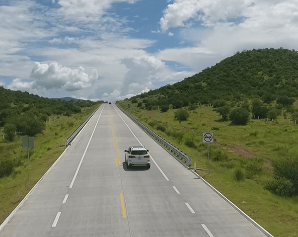
Driving in Mexico Map – from Tucson to San Carlos
🚗 Frequently Asked Questions About Driving to San Carlos, Mexico
Planning your first drive to San Carlos, Mexico? You probably have questions about safety, travel time, and what you’ll need at the border. Below, we’ve answered the most common traveler questions—based on real experience from countless road trips down Highway 15—so you can hit the road with confidence and peace of mind.
🕒 How long does it take to drive to San Carlos?
Driving to San Carlos, Sonora, Mexico takes about 7 hours from Phoenix or 5 hours from Tucson, depending on border wait times and traffic through Hermosillo. The route along Mexico Highway 15 is well-maintained, and most travelers complete the trip comfortably in a day.
🛡️ Is it safe to drive to San Carlos, Mexico?
Yes — driving to San Carlos is considered safe for travelers who use common-sense precautions. Stick to daylight driving, obey speed limits, and follow the main highway (Highway 15). Many visitors make this trip weekly without issue. Checkpoints are routine and generally friendly.
🚘 Do I need insurance to drive in Mexico?
Yes. Mexican law requires drivers to have Mexican auto insurance, as U.S. or Canadian policies aren’t valid. You can purchase coverage online or at the border. Carry a printed copy of your policy at all times in case you’re stopped at a checkpoint.
🛣️ What is the Hermosillo bypass?
The Hermosillo Bypass (Libramiento Hermosillo) is a 40-kilometer toll road that lets drivers avoid city traffic and save up to 40 minutes of travel time. The toll costs about 151 pesos per car (as of 2026). Follow signs for “Guaymas / Libramiento” when heading south on Highway 15.
🪪 Can I drive in Mexico with a U.S. license?
Yes — U.S. and Canadian driver’s licenses are valid in Mexico for tourists. There’s no need for an international permit if you’re visiting short-term. Just make sure your license is current and matches the name on your passport and car registration.
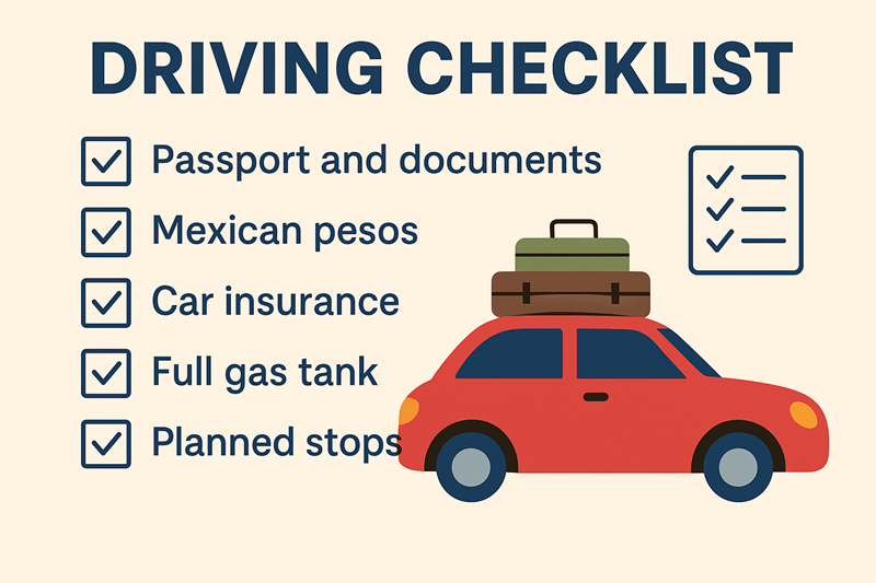
📄 What documents do I need to cross the border?
To drive to San Carlos, Sonora, you’ll need:
-
A valid passport
-
A tourist visa (FMM), which you’ll get at Km 21 checkpoint
-
Mexican auto insurance
-
Vehicle registration and proof of ownership
If you plan to travel outside the Sonora Free Zone, you’ll also need a temporary vehicle importation permit.
🚗 Ready to Hit the Road?
Now that you know how to drive safely to San Carlos, Sonora, Mexico, it’s time to plan the fun part of your trip. Use our detailed travel tips and safety checklist to make sure you have everything you need—from Mexican car insurance and travel documents to route maps and border updates. Whether you’re coming from Arizona, California, or beyond, this scenic drive down Mexico Highway 15 to San Carlos is one of the most enjoyable road trips in northern Mexico.
🌴 Plan the Rest of Your San Carlos Adventure
Your road trip is just the beginning—now it’s time to explore everything San Carlos, Sonora has to offer. Start with our San Carlos Travel Guide, your ultimate overview of this seaside paradise, from stunning beaches to local culture and must-see landmarks.
If you’re wondering when’s the best time to visit San Carlos, we break down the ideal months for sunny weather, calm seas, and exciting local events. Don’t miss our list of the Best Beaches in San Carlos—perfect for snorkeling, paddleboarding, or just relaxing on the sand.
Looking for adventure? Discover unforgettable experiences in our Things to Do in San Carlos, Sonora guide, from hiking Tetakawi Mountain to diving in crystal-clear coves. You can also plan your stay with our Where to Stay in San Carlos page, featuring handpicked hotels, resorts, and vacation rentals. And of course, no trip is complete without great food—discover local favorites, seaside dining, and hidden gems in our Best Restaurants in San Carlos guide.
And before you go, check out the Events & Festivals in San Carlos calendar to experience the local music, food, and community celebrations that make this coastal town so vibrant all year long.
🌅 Your San Carlos Journey Awaits
San Carlos is closer than you think—and even more breathtaking than you imagined. Whether you’re chasing sunsets over the Sea of Cortez, strolling golden beaches, or discovering hidden coves, every mile of the journey is worth it. So pack your bags, start your engine, and let San Carlos welcome you with open skies and endless adventure.